stream geomorphology
Overview
Streams geomorphology and habitat are important components of healthy streams. The focus of this project was to quantify the physical geometries of the streams to evaluate relative impairment.
The EPA's Environmental Monitoring and Assessment Program (EMAP) establishes procedures to evaluate overall stream health. This study focuses on one of their components of assessment: relative bed stability (RBS), or the evaluation of present stream substrates and expected substrate sizes in order to establish physical stream impairment. In other words, how much alteration and influx of sediment have occurred in a stream, and if that has impacted stream habitat.
EMAP procedures establish three levels of impairment: "Good Condition", "Impaired", and "Highly Impaired". Classifications are based on the log of relative bed stability. The calculations for relative bed stability rely on stream geometries and the stream substrates. The stream geometries measured include these elevations: thalweg (deepest), water surface, bankful; and these widths: water surface, and bankful. These geometries, along with an understanding of the bed substrate influence biological habitat and conditions. By monitoring biological habitat, and macroinvertebrate health we can better monitor changes to streams and as a result of pipeline construction.
methodology
The methods for this project are based on Kaufmann et. al in EPA document 620/R-99/003, published in 1999. Methods were slightly modified to better fit this experiment and better represent the study reaches. Below a summary outlines the methods followed and modified:
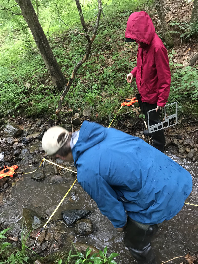
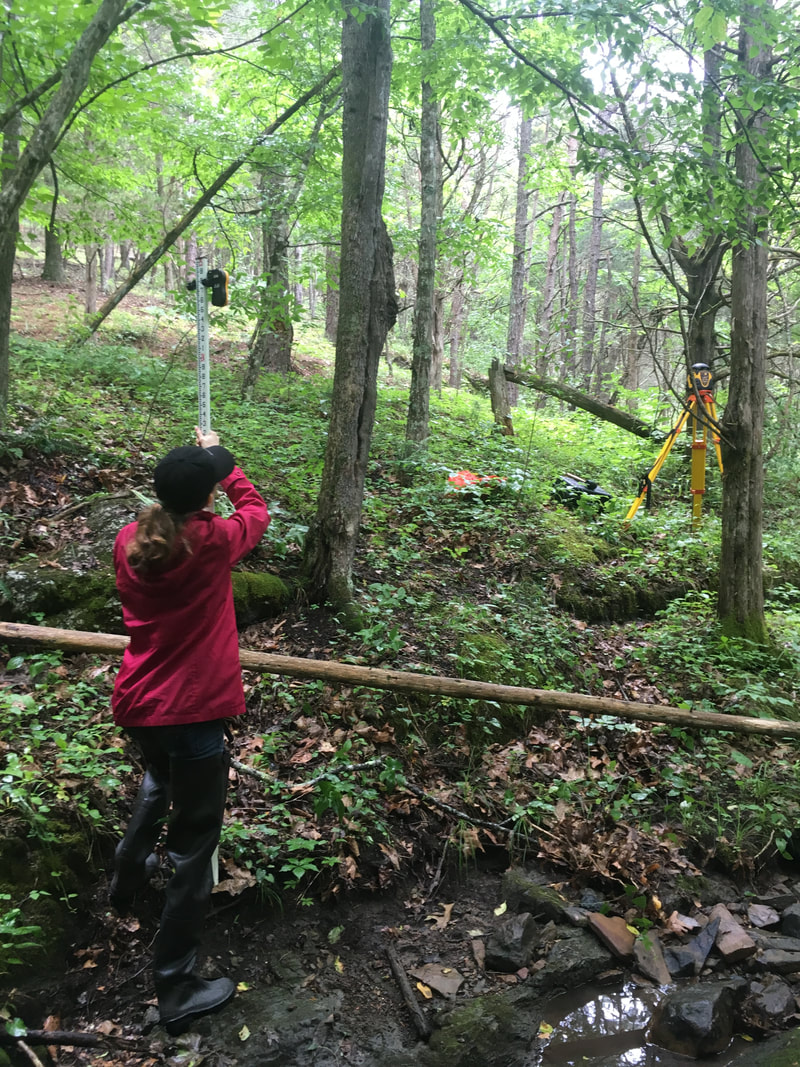
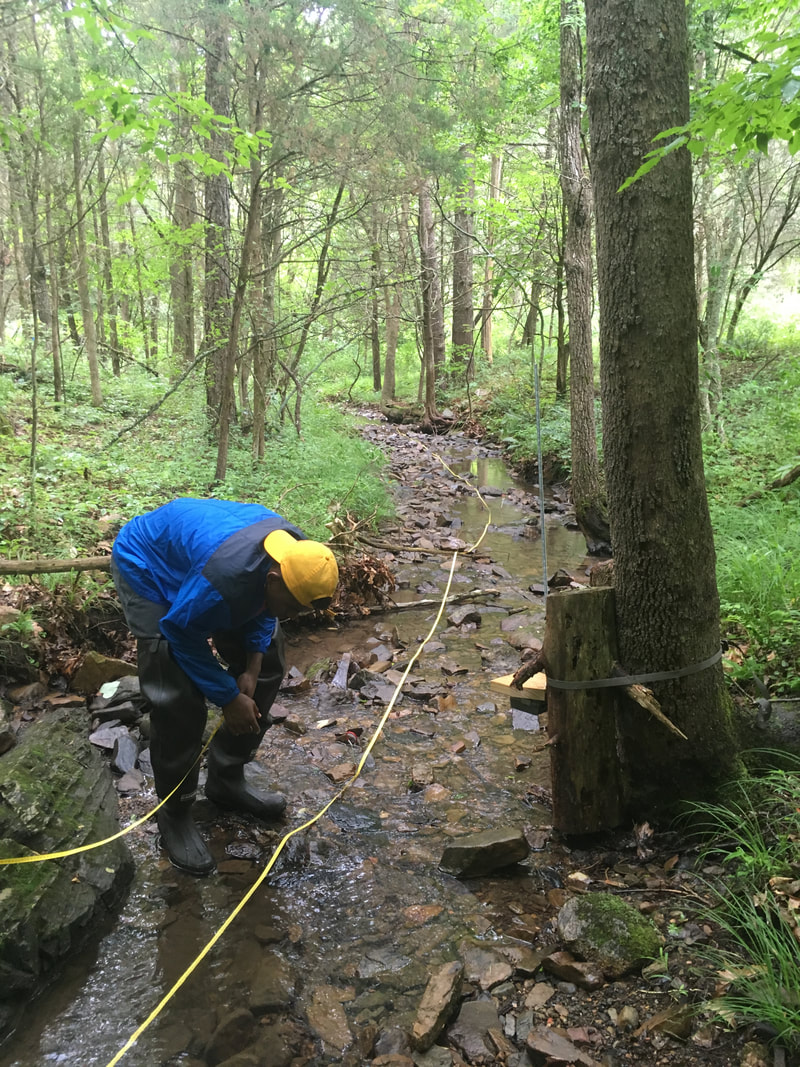
Study reaches were measured out, with the objective of having a longitudinal length about 20 times the wetted width of the stream. From there, surveying would begin. Every 6-8 meters, relative heights were obtained using a laser level for thalweg (deepest point), water surface, bankful height. Wetted widths and bankful widths were also obtained. 11 cross sections were used to measure 5 substrate diameters. Large woody debris was tallied, but ultimately not used in analysis. Additionally, to better represent the stream substrate, a large pebble count of 115-150 points was conducted over a central riffle.
All calculations were done in Matlab using LiveScripts and function files written directly.
Using stream geometries (depths and elevations) we calculated stream gradient and bankful hydraulic radius :
Stream gradient (S) = average((Δwater surface height)/(Δdistance)
Bankful hydraulic radius (Rbf) = 0.5*average(thalweg_depth)*average(bankful_height)
By plotting the pebble counts as a particle size distribution, D50 was calculated using a linear regression for the closest two points to 50% finer. Ultimately, it was determined the large riffle pebble count better reflected stream substrates, and D50 was calculated using the large pebble count, despite EPA guidelines to use the 55 points from the cross-sections.
Together with stream gradient (S), median grain size (D50), and hydraulic radius (Rbf), relative bed stability (rbs) and was calculated:
RBS=D50/Dcbf=D50/(13.7*S*Rbf)
Impairment values were based on EPA guidelines for Mid-Atlantic Highlands region using the log of relative bed stability:
"Good Condition" >0.2 to 1.0
"Impaired" >-1 to 0.2, and >1.0 to 2.0
"Highly Impaired" <-1.0 and >2.0
Results
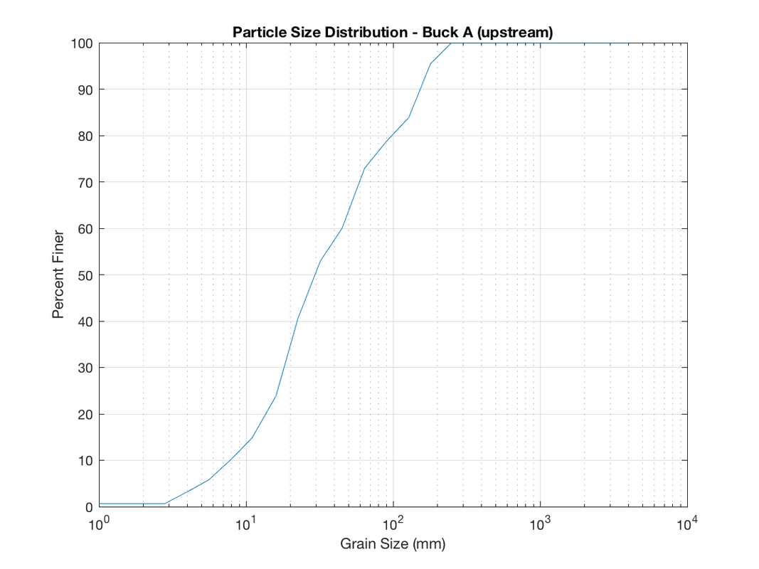
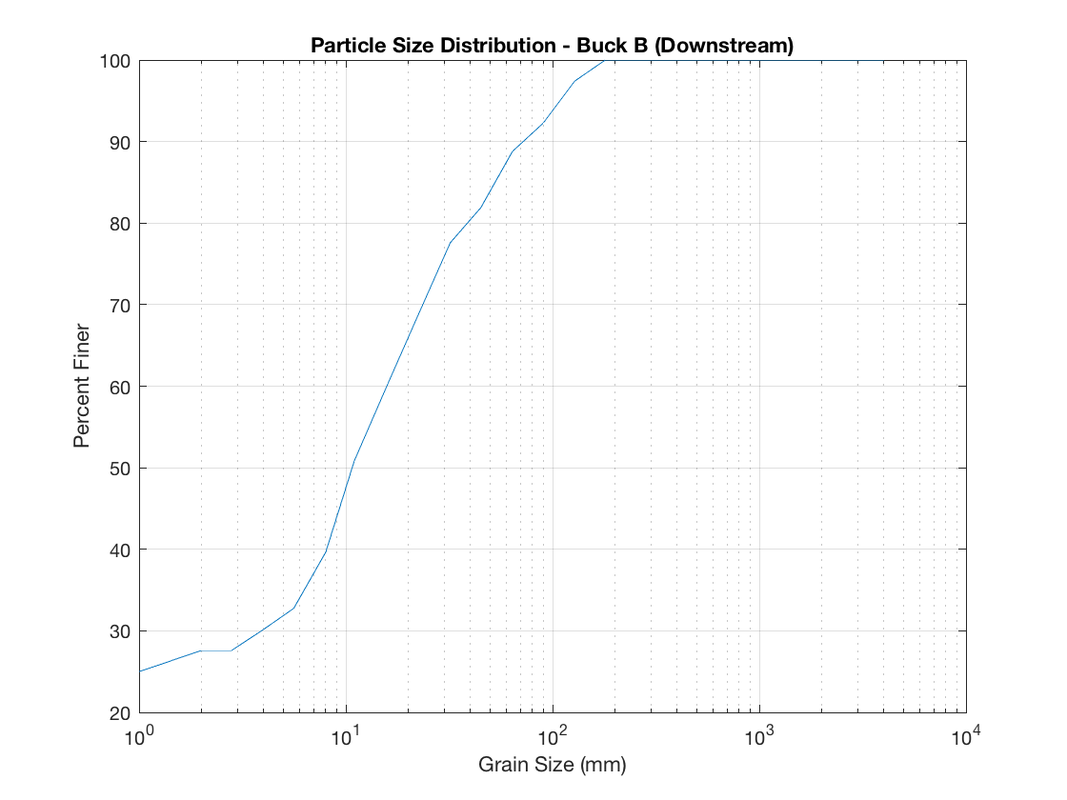
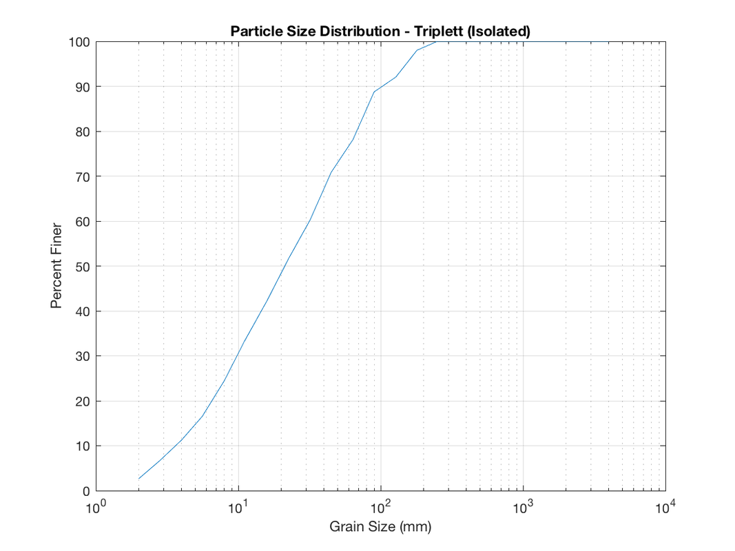
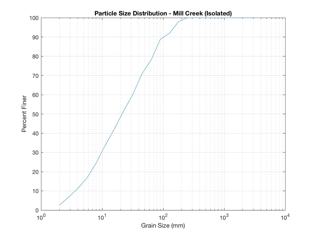
Overall the median grain size of the streambed decreased from 60.2mm upstream of the pipeline to 10.7mm immediately downstream of the pipeline. This is evident in an increase of fines downstream, where nearly 26% of the stream substrate is fine sediment. The resulting D50 and RBS value assigned the EPA rating of “Impaired”, but approaching “highly impaired” downstream of the pipeline right-of-way. Relative Bed Stability values at the upstream site along with the two isolated sites indicated streams in "Good Condition".
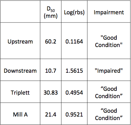
Table summarizing results of relative bed stability model
Particle Size Distribution Curves
conclusion
The downstream site's rating of "Impaired" indicates physical alterations as result from pipeline construction, whereas other sites studied remain in "Good Condition". Further monitoring should be conducted as pipeline construction continues, particularly in wetter periods in southwest Virginia.
REFERENCES
EPA Environmental Monitoring and Assessment Program:
P. R. Kaufmann, Quantifying physical habitat in wadeable streams. Research Triangle Park, NC: Environmental Monitoring and Assessment Program, National Health and Environmental Effects Research Laboratory, Office of Research and Development, U.S. Environmental Protection Agency, 1999.
Document Reference: EPA/620/R-99/003
